|
Maps, supports a wide variety of of graphics formats
and hundreds of map projections from around the world. Enhance
your maps by adding contour lines, height coloring or relief
light shading.
Generate your own quality copyright free maps (ideal for
publication) from SRTM height data (covering North and South
America, Europe, Asia and Africa) and any tracks or waypoints
you have.
Automatically downloads ready calibrated USGS topographic
maps and aerial photographs from TerraServer.
|  |
|
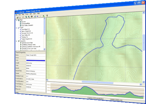
Garmin GPS Interface, Compatible with all Garmin devices
(including the Forerunner). Allows you to download tracklogs,
routes and waypoints to view on the map. Speed analysis from
tracklogs shows mile or km split times. Plan your routes on
the map and then upload to your device. |
|
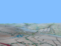
| 3D Rendering, Trailgauge uses a
game engine to render terrains in 3d in realtime. Allows
you to walk or fly over the terrain as you wish. Auto
fly-through your routes and record AVI movie files to
share with your friends and colleagues. Apply ground textures
blended into the map and add distance fogging to add realism
to the scene. Take screenshots of views to compare with
photographs. Configurable screen size including full-screen
mode for maximum effect. |
|
|
|
Relational Database, Store all of your GPS assets in
the built in database which allows user configurable 'views'
of the data. Advanced users can even specify their own SQL queries
to work with their data.. |
|
Smooth Height Map, Using freely
available detailed Shuttle Radar Topography Mission data, Trailgauge
automatically downloads, filters and stores the data for your
maps. Trailgauge uses a sophisticated interpolation technique
to produce a continuous smooth surface over your map. This allows
for accurate ascent measurements and spot heights unlike the
gross values calculated by software using simple polygon meshes
for interpolation. |
|
Precise calculation of distance and times, Trailgauge
calculates precise distances and times for awhole route or any
point along it. Both time and distance calculations take elevation
into account. Build your own list of 'speeds' representing walking,
running and cycling finely tuned to take gradients into account. |